Public Observation
Observation Details
Observation Date:
March 16, 2023Submitted:
March 17, 2023Zone or Region:
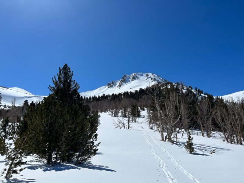
Mammoth LakesActivity:
Skiing/SnowboardingLocation:
Sherwins Snowpack and Weather ObservationObservations
We toured into the Sherwins today to get a sense of weather and snowpack conditions. Given 3 avalanche problems on the forecast we targeted warming at the surface, distribution of snow by wind and persistent layers buried deeply in the snowpack. Here is what we found.
- Temperatures warmed near freezing at 9500 at mid day.
- Surface warming was present on aspects tilted toward the sun, but we did not see signs of instability.
- Winds were light from the N and we did not see any active wind transport of snow.
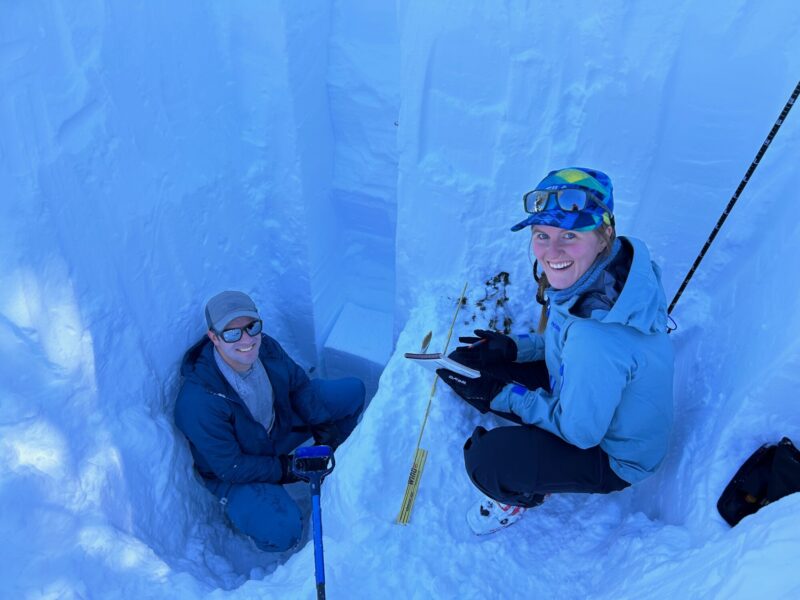
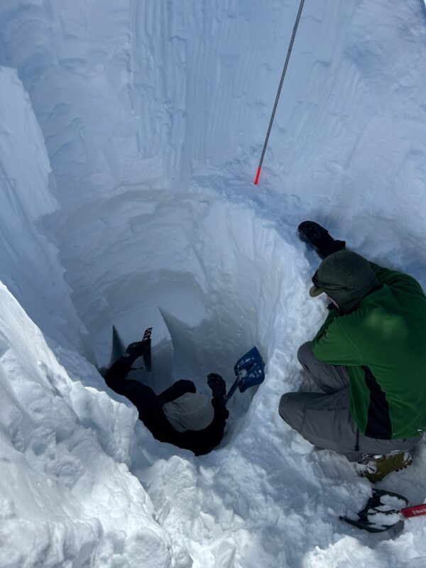
- We dug two snow profiles near each other on a NW aspect at 9500 feet.
- Persistent grains were found about 260cm deep the the snowpack, but did not produce results on a Deep Tap Test. Grains were identified as FCxr 0.5mm
- Skiing/riding was challenging at times due to a melt and refreeze crust preserved even in the most sheltered locations in the Sherwins. This probably had something to do with the warm nature of our last storm event.
Field Weather Observation
Location Mirkwood
Time 13:46
Elevation 9500
Aspect NW
Sky CLR
Tair/Tsurf/T20 -2.0/-7.5/-7.5
Precipitation Type/Rate NO
Wind L->NE
Blow Snow None
Surface Form/Size FC
HST 4cm
HS >300cm
Pen Boot/Pen Ski 5cm/35cm
Comments Crust still present 4cm from surface 12cm thick
HS measured at 515cm and 580cm nearby.
Signs of Unstable Snow
Media