
Professional Observation
Basic Information
Observation Details
Observation Date:
March 19, 2023 - March 19, 2023Submitted:
March 19, 2023Observer:
Clancy Nelson | ESAC ForecasterZone or Region:
Mammoth LakesLocation:
Mammoth Lakes Basin - Touchy, And Growing Wind SlabsSigns of Unstable Snow
Recent Avalanches?
YesCracking?
IsolatedCollapsing?
None ExperiencedKey Points
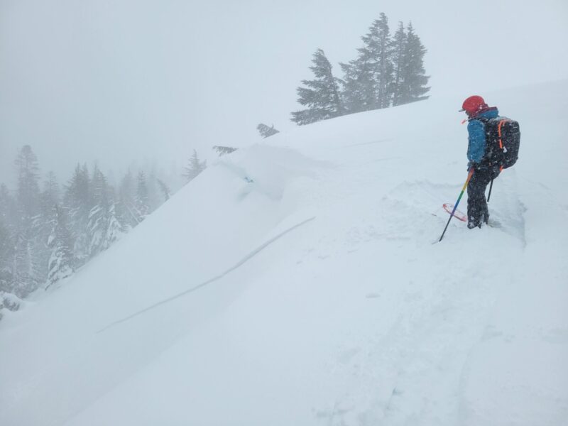
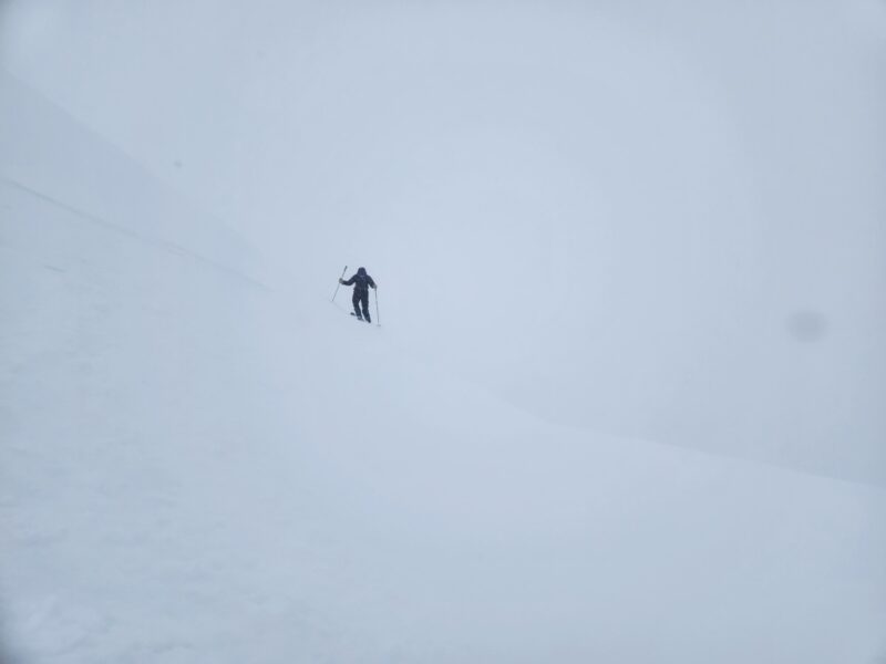
We went to the Mammoth Lakes Basin to watch today’s wind slab problem develop and we were not disappointed.
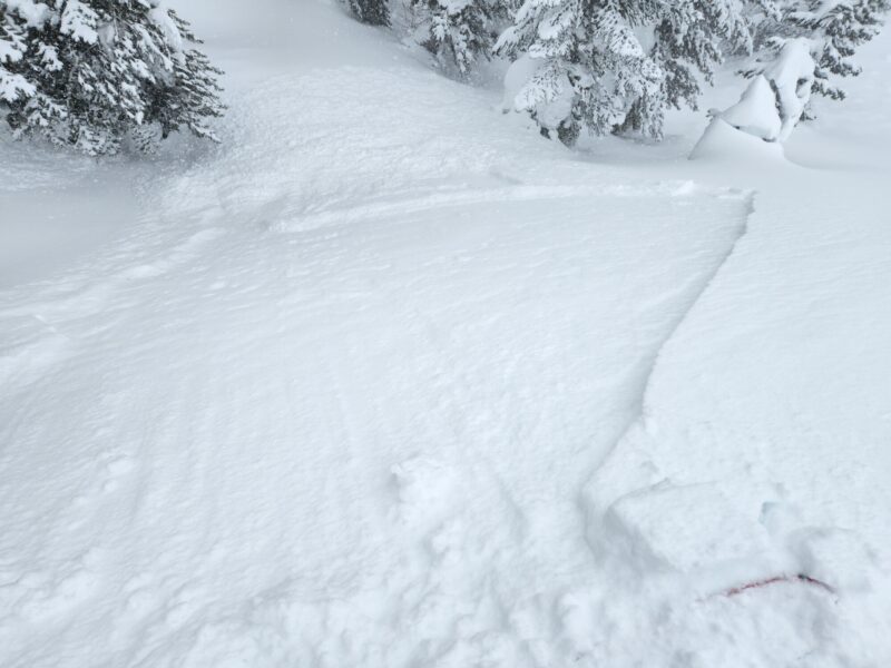
- We found touchy (very easy to trigger) wind slabs on north and east-facing test slopes near treeline in the afternoon. We remotely triggered several. These were only about 4-inch deep soft slabs (4-finger hardness), but they were growing quickly and broke widely. (See avalanche observations and video for more information.) We also triggered a few very small sluffs in sheltered terrain where the new snow slid on a recent melt-freeze crust.
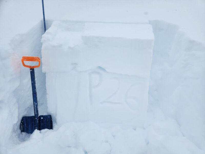
- We tracked the crusty surfaces the new snow was falling onto. We found a mostly supportable melt-freeze crust on all aspects below treeline and up to over 10,000 feet on east and southeast where it thins to just 1 cm thick, has 1-finger (1F) hardness, and is breakable. We got repeatable propagating test results in one of our snow pits on an east aspect at 10,300 feet. Extended column tests propagated with hard force (ECTP 26) in a layer of unconsolidated snow 30 cm below the surface sandwiched between a 1F hard wind-packed layer above and the dense (Pencil) snow from the 3/14 storm. With new, reactive slabs developing on east aspects, these test results indicate that avalanches could break a little deeper than just at the new/old snow interface. In our pit on a northwest aspect at 10,200′ we got sudden planar results in small column tests and non-propagating results in the same layer (CTM SP, ECTN 15) 20 cm below the surface.
- Winds, blowing snow, and snowfall rates increased throughout the day and with elevation. Visibility above treeline was poor.
Aside from our small test slopes, we avoided steep, large slopes that were getting wind-loaded and found decent skiing in the few inches of new snow atop the older crusts.
Media
Advanced Information
Weather Summary
Cloud Cover:
ObscuredTemperature:
Temps stayed below freezing below 8,000 feet.Wind:
Moderate , SW
Strong gusts from the south and southwest with moderate to intense blowing snow. Snowfall rates of less than 1 inch/hour (S1) to a little more than 1 inch/hour (S2+). The new snow was rimed, almost graupel (PPir) and needles (PPnd).
Avalanche Observations
| # | Date | Location | Size | Type | Bed Sfc | Depth | Trigger | Comments | Photo |
|---|---|---|---|---|---|---|---|---|---|
| 4 | Today |
Panorama Dome NE 8900 ft |
D1 | SS | I-New/Old Interface | 4 inches |
AS-Skier r-Remote |
None | |
| 1 | Today |
Red Cone Trees N 9400 ft |
D1 | L | I-New/Old Interface | 2 inches |
AS-Skier c-Intentional |
None |