
Professional Observation
Basic Information
Observation Details
Observation Date:
March 14, 2023 - March 14, 2023Submitted:
March 14, 2023Observer:
Clancy Nelson | ESAC ForecasterZone or Region:
Mammoth LakesLocation:
Mammoth Area - Storm Instabilities and Intense LoadingSigns of Unstable Snow
Recent Avalanches?
YesCracking?
WidespreadCollapsing?
None ExperiencedKey Points
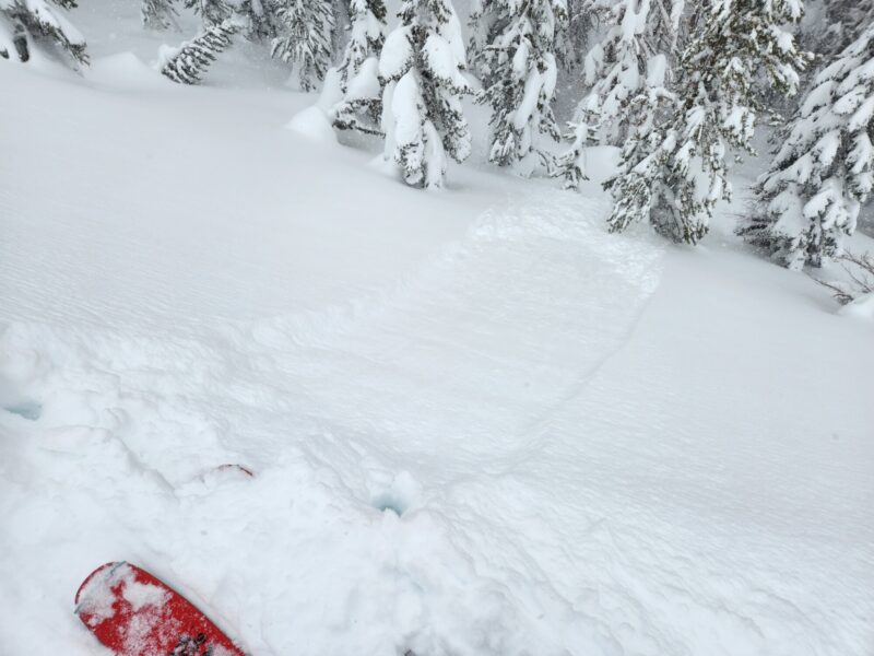
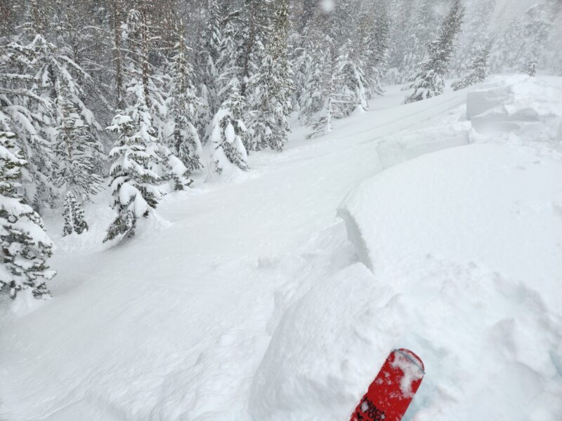
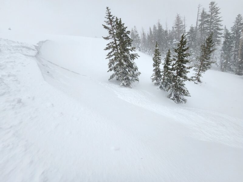
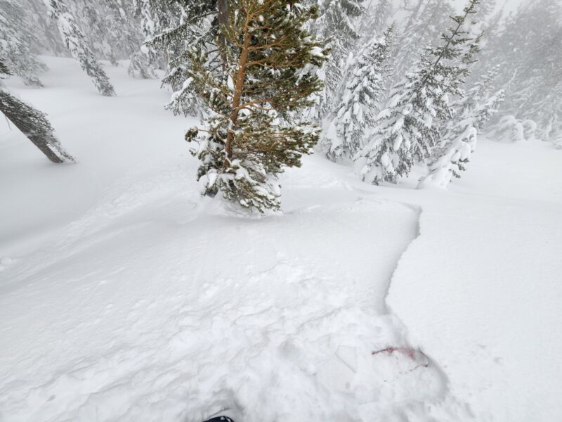
It should come as no surprise that stability was deteriorating today as the storm ramped up. I traveled near and below treeline across almost every aspect in the Mammoth area to see the effects of heavy snowfall and wind loading midday. I was not disappointed.
- Storm instabilities: wind slabs, storm slabs, and dry sluffs, were easy to trigger on test slopes on just about every aspect. Cornices from yesterday and this morning were touchy – very easy to trigger. Everything I triggered broke at the new/old snow interface. Slides ran fast and far, entraining a lot of soft new snow.
- It was snowing more than 2 inches per hour. It snowed 6 inches in 2 hours while I was out. The new snow was dry, despite temps rising slightly from just below, to just above freezing midday. I could tell it was warm before getting out my thermometer. Despite the dry nature of the new snow, I was getting soaked in my gore-tex. The sheer intensity of snowfall made the new snow settle fast and I was getting lots of cracking around my skis in flat terrain later in my tour.
- Strong to extreme southwest winds were loading leeward terrain features near treeline and limiting visibility.
- As I drove up from Bishop in the morning, the rain/snow line was at 6400 feet. On the drive down around 1 pm it had risen to 6900 feet. I saw some large rollerballs and a few small wet loose sluffs on the side of the road below 7000 feet where there was still snow cover.
Media
Advanced Information
Weather Summary
Cloud Cover:
ObscuredTemperature:
Rising from -0.5 C to 1 C between 10 am and 1230 pmWind:
Strong , SWAvalanche Observations
| # | Date | Location | Size | Type | Bed Sfc | Depth | Trigger | Comments | Photo |
|---|---|---|---|---|---|---|---|---|---|
| 4 | Today |
Mammoth City and Mill City Areas N 8500 ft |
D1 | L | I-New/Old Interface | 6 inches |
AS-Skier c-Intentional |
Long and fast-running sluffs on multiple aspects in sheltered terrain. | None |
| 4 | Today |
Panorama Dome NE 8900 ft |
D1 | WS | I-New/Old Interface | 8 inches |
AS-Skier c-Intentional |
4F soft slabs. Slabs in some areas were already up to 40 cm deep. | None |
| 2 | Today |
Panorama Dome NW 8800 ft |
D1 | SS | I-New/Old Interface | 6 inches |
AS-Skier c-Intentional |
None |