Professional Observation
Basic Information
Observation Details
Observation Date:
March 12, 2023Submitted:
March 12, 2023Observer:
Everett Phillips | ESAC ForecasterZone or Region:
June LakeLocation:
June Mountain Backcountry - Blowing Snow and WarmingSigns of Unstable Snow
Recent Avalanches?
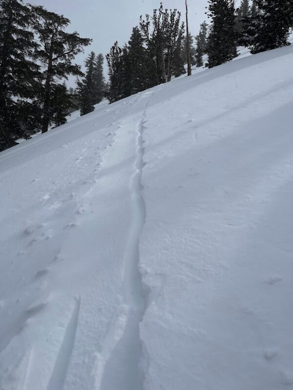
YesCracking?
IsolatedCollapsing?
None ExperiencedKey Points
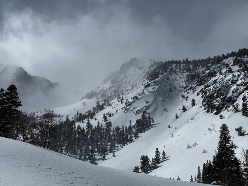
Headed to sheltered near and below treeline terrain in the June Mountain Backcountry to get a feeling for the new snow.
- Snowfall up to 2″ per hour in the afternoon above 10000′. Moderate blowing snow. Visibility obscured above treeline.
- Air temp. was just above freezing (34 F) at 9000′ at noon.
- Below 8500′ the surface snow was moist to wet. Rollerballs could be created by turning agressively on convexities.
- Surface snow was damp up to 10000′ on E and SE terain BTL and NTL.
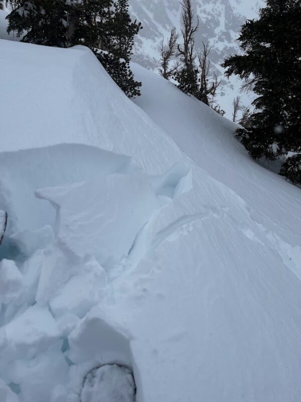
- Some slab formation and cracking on steep test slopes NTL.
- Feb, PWL is over 2 meters below the snow surface.
Media
Advanced Information
Weather Summary
Cloud Cover:
ObscuredTemperature:
25F @ 10000' at 2 PMWind:
Moderate , SW
Blowing snow and snow showers increased throughout the day. The temperature was just above freezing at 9000′ at noon.
Avalanche Observations
| # | Date | Location | Size | Type | Bed Sfc | Depth | Trigger | Comments | Photo |
|---|---|---|---|---|---|---|---|---|---|
| 2 | Past 24 hours |
Yost Drainage SE 9500' |
D1 | L | S-New Snow | N-Natural | None |
Snowpack Observations
9000′ flat BTL clearing:
- HS > 360cm
- HST: 120cm
- Feb. PWL was probed at 195 to 202cm below the surface. That translates to about 6′ 9″.
- Ski pen in areas without wind effect ~ 25cm. Boot 60cm – 75 cm.
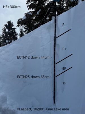
10200′ N aspect:
- Fresh wind slabs were forming in terrain conducive to wind loading by SW winds.
- In sheltered areas the upper 100cm of the snowpack is right side up. F hard snow down to ~ 60cm below the surface. 4F becoming 1F down to a meter deep.