
Professional Observation
Basic Information
Observation Details
Observation Date:
March 3, 2023Submitted:
March 4, 2023Observer:
Everett Phillips | ESAC ForecasterZone or Region:
Mammoth LakesLocation:
Sherwin Ridge - Stubborn PWLSigns of Unstable Snow
Recent Avalanches?
YesCracking?
None ExperiencedCollapsing?
None ExperiencedKey Points
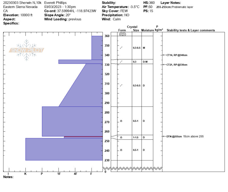
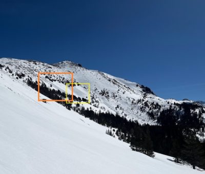
Went out on 3/3/23 to Sherwins to dig to the Feb. PWL. I was looking for a pit location without exposure to avalanche hazard (not in track or start zone) ~10,000′ on a northerly aspect where the PWL was within 150cm of the snow surface. I found a good spot just west of the summit of Red Mountain where snow was semi-protected by sparse trees and a convexity.
- NTL the Feb. PWL was found between 105cm to 150cm below the snow surface
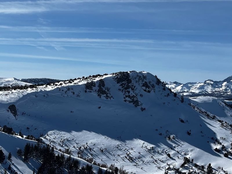
- A large crown on the NE side of the “Perch” (Rock Chute area) confirmed that the PWL had been active in the area during the last avalanche cycle
- Where I dug the PWL was down 105cmm and consisted of 3cm thick layer of 1F- hardness, 1.5mm rounding facets. The layer did not react in a deep tap test (DTN) (see attached profile).
- Great day for pit digging warm, sunny, calm winds.
Media
Advanced Information
Weather Summary
Cloud Cover:
Mostly SunnyTemperature:
26 FWind:
CalmAvalanche Observations
| # | Date | Location | Size | Type | Bed Sfc | Depth | Trigger | Comments | Photo |
|---|---|---|---|---|---|---|---|---|---|
| 1 | Past 48 hours |
Sherwins SW slopes SW 10000' |
D1.5 | WL | S-New Snow | 20cm | N-Natural | 20230302 |
|
Snowpack Observations
- HS ~ 400cm in leeward terrain (N, NE and E) NTL,
- HS ~ 75cm on windward terrain (S and SW)
- Surface snow near and above treeline is wind hardened on N, NE, and NW. It is loaded on E and eroded on W.
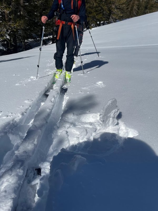
- Overall ski pen NTL was between 0 and 10cm. Breakable wind crust on cold slopes, and breakable sun crust on solars.
- The MFcr did not breakdown with warming today on S and SW slopes.
- BTL north facing snow above 8200′ did not have a temperature crust and ski pen was ~35 to 40cm in wind protected areas.