Professional Observation
Basic Information
Observation Details
Observation Date:
December 26, 2022 - December 26, 2022Submitted:
December 26, 2022Observer:
Clancy Nelson | ESAC ForecasterZone or Region:
Lee ViningLocation:
Lee Vining Canyon - Wet Snow And Pre-Storm ConditionsSigns of Unstable Snow
Recent Avalanches?
None ObservedCracking?
None ExperiencedCollapsing?
None ExperiencedKey Points
We went to Lee Vining to look for any wet snow instabilities and track surface conditions before the incoming storm.
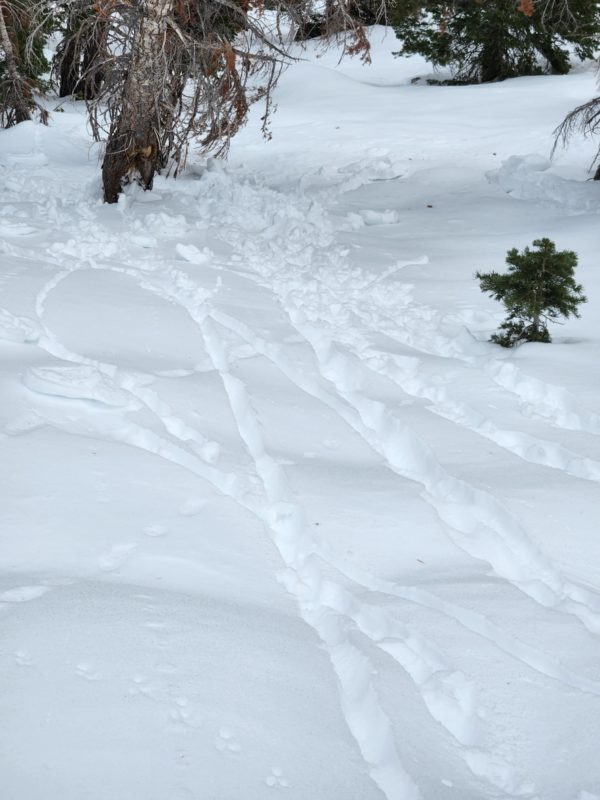
- On very steep, northeast-facing, treed slopes we triggered many rollerballs and some very tiny wet loose avalanches. Poor refreeze overnight and continued warm temps conspired to keep the surface snow wet. Trees insulated the surface and made it worse.
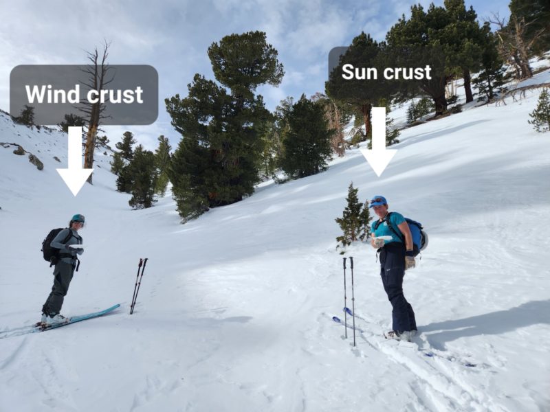
- Above 9,000 feet, northerly slopes were dry winter snow, while southerly slopes were still in the melt-freeze cycle. We saw sun crusts on sunny slopes, hard slick wind crusts in exposed terrain, and weak near-surface facets in sheltered terrain.
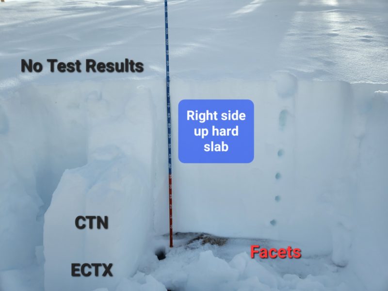
- We dug a hasty pit and performed a few snowpack tests near treeline on a north-facing slope. We found facets at the ground under a hard slab, though we got no test results.
The incoming storm will drop new snow on a variety of surfaces above 9,000 feet. It may not bond so well with some of them. If avalanches run down to lower elevations they will have wet snow to entrain.
Media