
Professional Observation
Basic Information
Observation Details
Observation Date:
December 21, 2022Submitted:
December 21, 2022Observer:
Everett Phillips | ESAC ForecasterZone or Region:
Rock CreekLocation:
Rock Creek - Wind Transport Above TreelineSigns of Unstable Snow
Recent Avalanches?
None ObservedCracking?
IsolatedCollapsing?
IsolatedSeveral collapses while climbing a NW facing forest between 10400′ and 11600′.
Key Points
I wanted to get up high in Rock Creek to see what today’s winds were doing with snow in the high alpine. I also got a look at the Persistent Slab problem above 11,000′.
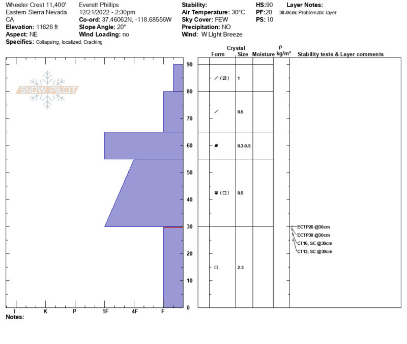
- P Slab: Poor snowpack structure is on display in Rock Creek, and it is not better at higher elevations. Propagation in Extended Column Tests and whumpfing are still present in NTL elevation band on NW to NE aspects. HS was between 40 and 100cm. As the saying goes, “A thin snowpack is a weak snowpack”.
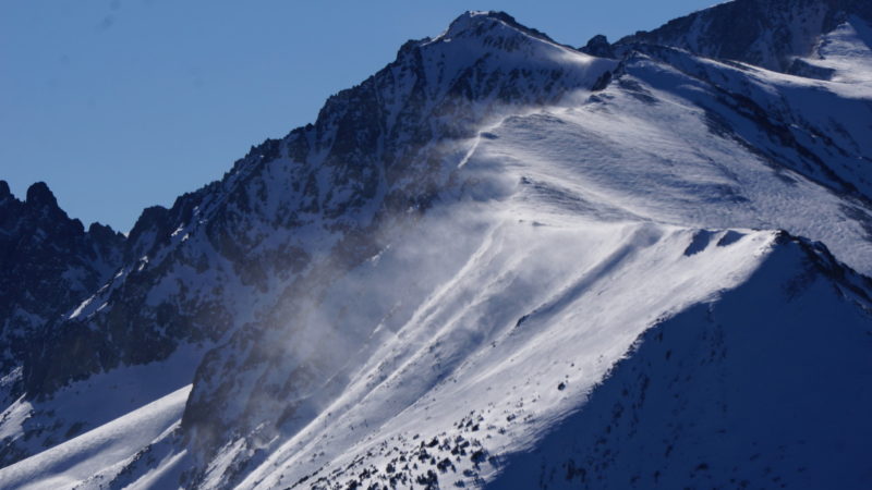
- Wind Slab: Blowing snow could be seen on isolated ridgelines in the high alpine. This was seen on a 13000′ ridge on Morgan, but not on other similar ridges in the area. A great example of subtle differences in terrain creating spatial variability.
- Below Treeline the main hazard is low snow. Plenty of objects to hit while riding.
Media

Advanced Information
Weather Summary
Cloud Cover:
Mostly SunnyTemperature:
30FWind:
Moderate , W
It reached 30F at 11800′ by 1pm. As I skied out I kept scooping up surface snow and checking the moisture content. Unless in direct sun the surface snow did not get overly wet above 9000′. Below 9000′ it made good snowballs easily. Trees were dripping water onto the snow surface below 10000′. Winds seemed to keep the warming to a minimum NTL and ATL.
Close