
Professional Observation
Basic Information
Observation Details
Observation Date:
December 7, 2022 - December 7, 2022Submitted:
December 7, 2022Observer:
Clancy Nelson | ESAC ForecasterZone or Region:
Rock CreekLocation:
Rock Creek - Southeast Aspects Snowpack and More Wind Than ExpectedSigns of Unstable Snow
Recent Avalanches?
YesCracking?
WidespreadCollapsing?
WidespreadThere was more blowing snow at ridges than we expected. On a small east-facing test slope at 11,100 ft we intentionally triggered a very small, soft wind slab.
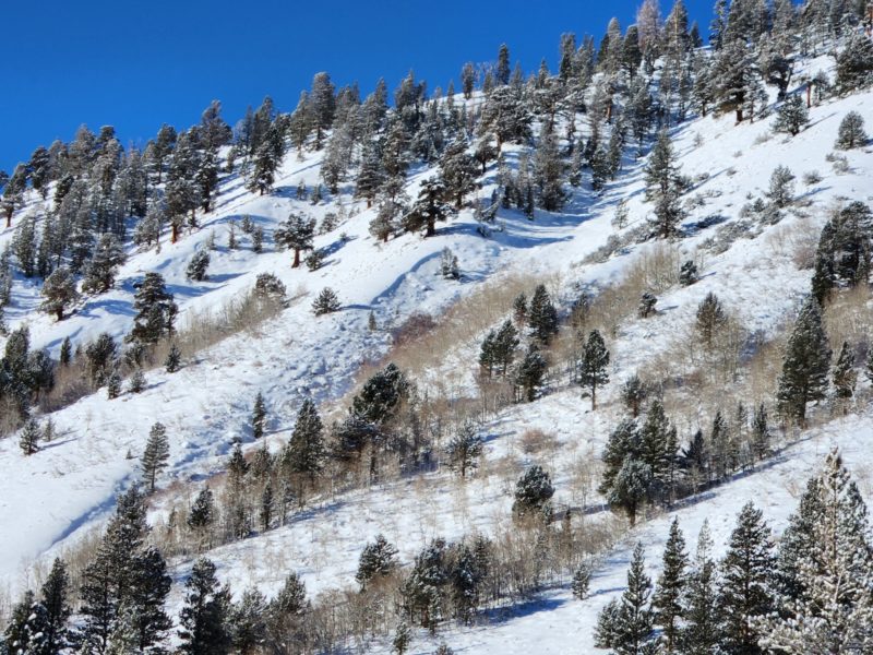
We experienced lots of localized cracking and collapses between 9500 ft and 10500 ft. These were only in east-facing areas that had snow prior to the December 1st storm. On southeast terrain where the storm snow sat on bare ground or hard melt-freeze crusts, we didn’t see any.
Key Points
We went looking for the persistent slab problem on southeast aspects, and for any new wind slab development. Didn’t find the first, but saw more blowing snow than expected.
Media
Advanced Information
Weather Summary
Cloud Cover:
Mostly SunnyTemperature:
TeensWind:
Moderate , W
Winds were variable and light in the canyon, but westerly wind was blowing snow across the highest ridges all day.
Cold air temps but it felt warm in the sun.
Avalanche Observations
| # | Date | Location | Size | Type | Bed Sfc | Depth | Trigger | Comments | Photo |
|---|---|---|---|---|---|---|---|---|---|
| 1 | Within the past week |
Hilton moraine above the East Fork Campground NE 9250 |
D1 | U | N-Natural | None | |||
| 1 | Within the past week |
Under the north facing cliffs of Patricia Bowl NE 10800 |
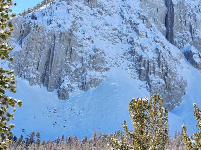
D2.5 | U | N-Natural | Likely failed on the 12/1 interface late in the weekend storm. | None | ||
| 2 | Within the past week |
Under the north facing cliffs of Patricia Bowl N 10800 |
D2 | U | N-Natural | Likely failed on the 12/1 interface late in the weekend storm. | None | ||
| 1 | Today |
Small test slope on the SE Ridge of Patricia Peak E 11100 |
D1 | SS | I-New/Old Interface | 10 cm |
AS-Skier c-Intentional |
None |
Snowpack Observations
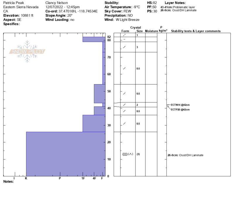
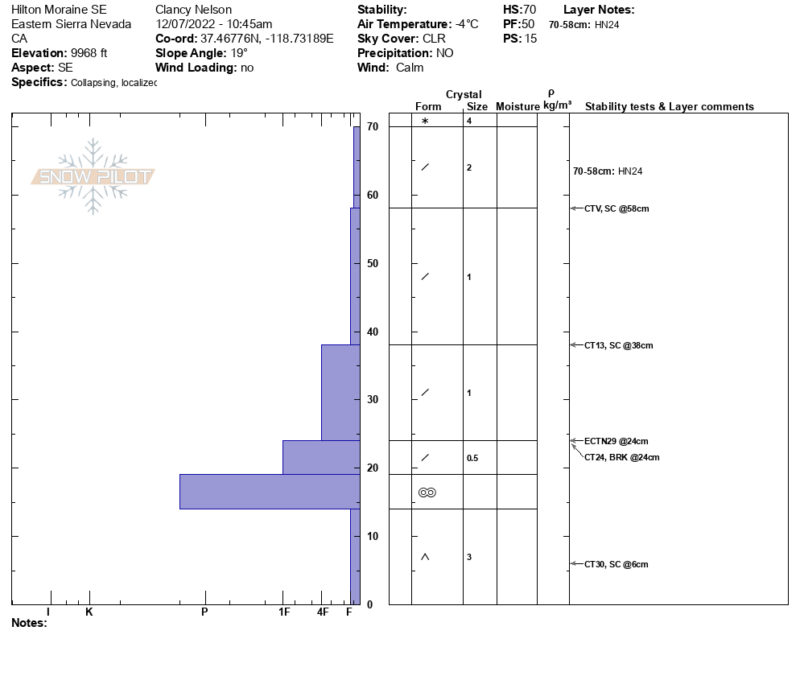
On southeast-facing slopes in Rock Creek, the facets from before the 12/1 storm – where they exist – rest under very hard and thick melt-freeze or wind crusts.
Snow depth below treeline = 35-75 cm. Near treeline = 35-85 cm. Above treeline = 125 cm+. 2-6 inches of new snow fell last night.
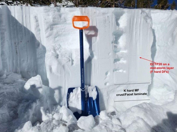
On southeast slopes with steeper inclines or more open areas, the storm snow from the past week is sitting on the ground. Interestingly, we got propagation in our snow pit tests on a mid-storm layer of fragmented grains 36 cm below the surface. One of these ECTs is depicted in our snow profiles, the other was at 11,080 ft on an east aspect.
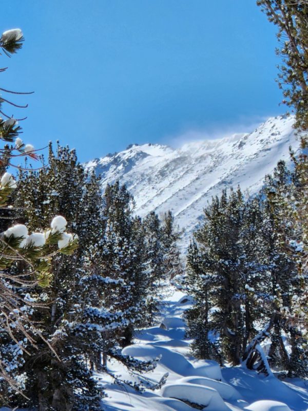
South through east aspects were developing thin sun crusts at the surface. Above 10,900 ft, some south aspects were wind-stripped almost to the ground.
New, soft wind slabs were forming above treeline on northerly and easterly aspects. Where we traveled they were forming on older, hard wind board.
See snow profiles for more detailed info.
Terrain Use
Though we were tempted to drop off onto steep northeast-facing terrain for deeper, softer snow, we stuck to our tour plan to limit our exposure to steep slopes that may harbor the persistent slab problem.
Close