
Professional Observation
Basic Information
Observation Details
Observation Date:
January 5, 2022Submitted:
January 7, 2022Observer:
Brooke Maushund | Pro ObserverZone or Region:
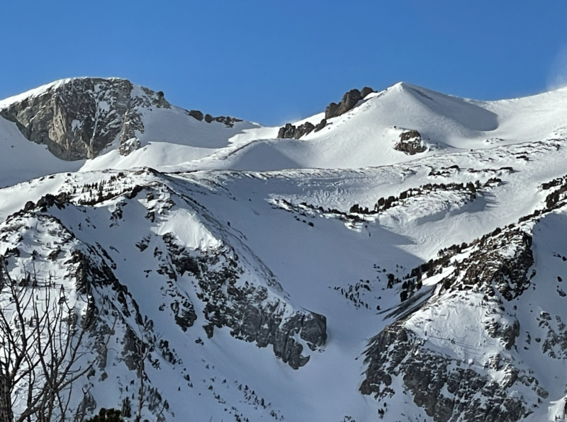
June LakeLocation:
San Joaquin RidgeSigns of Unstable Snow
Recent Avalanches?
YesCracking?
None ExperiencedCollapsing?
None ExperiencedKey Points
- Evidence of past significant (D2-D2.5) avalanches, most likely wind slabs, evident
- Avalanches appeared large enough to carry & bury a person or party
- While things have stabilized in the alpine, this upcoming wind storm could create conditions for similar events depending on wx & snow transport opportunities. Filling in of old slides prove wind transport is happening along the ridge, signaling caution after our wind event today
Advanced Information
Weather Summary
Cloud Cover:
ClearTemperature:
0.5°CWind:
Strong , NW
Gusty morning at June Mountain, with consistent wind in the moderate range at 0904 and intermittent gusts atop J7 reaching as high as 60mph, both coming from the NW — which still was under forecasted gusts. Clear skies, with temps hovering around freezing. Snow transport was evident across the San Joaquin Ridge, with billows of snow visible form across the drainage. The wind shifted throughout the day to the SW, so wind loading on all aspects possible. Snow surfaces just outside of the June Mountain boundary ducking onto NE slopes were variable from unsupportable to more stiff windboard, very textured sastrugi in the open, along with patches of soft cool snow in the most sheltered densest areas in the trees.
Avalanche Observations
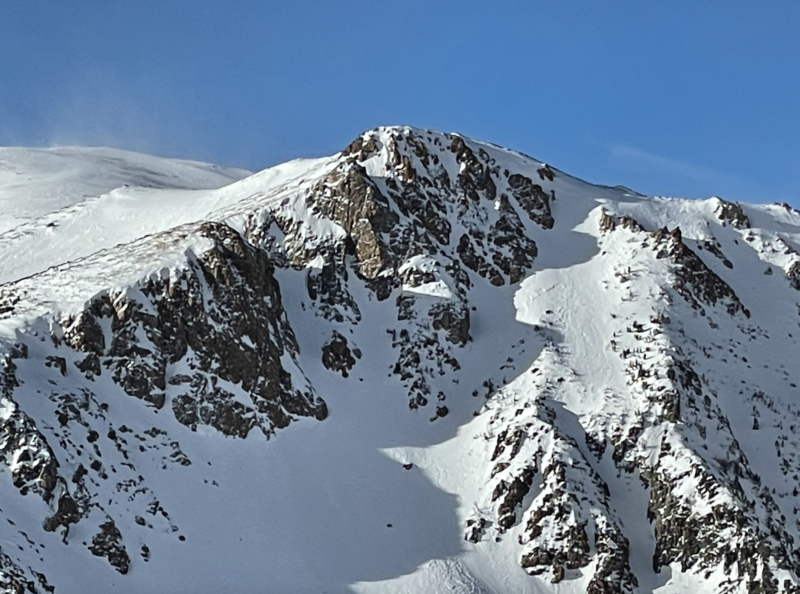
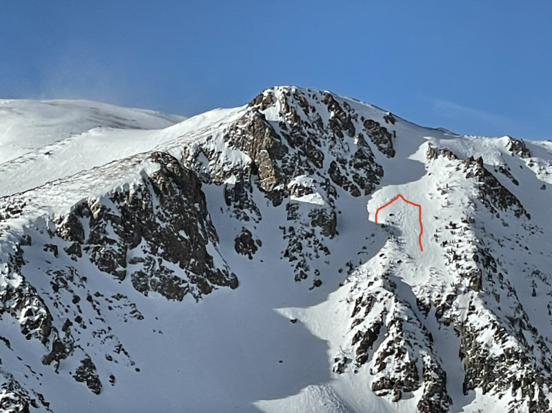
Evidence of 2 past avalanches (likely from January 2nd or 3rd judging by the rate & degree at which they have filled in with wind transport) evident on the San Joaquin Ridge & visible from J7
- Avalanche activity above The Hourglass (estimations made remotely from the top of J7):
NE-Facing/~40° start zone / 9900′ / R4 / D2.5 / HS / U – most likely N
Avalanche visible on looker’s L of Hourglass (see other photo for overlay)

Crown/flanks/stauchwall outlined in red
- Avalanche activity in N1 (estimations made remotely from the top of J7)
E-Facing/~37° start zone / 10800′ / R2 / D2 / HS / U
Avalanche visible on looker’s R of photo (see other photo for overlay)
Crown outlined in red
While these avalanches appear at least 72 hours old, it is a reminder that the wind slab problem can still be present. The rate at which they are filling in as well (they are barely visible now, a little more than a day later) is also a sign that there is still snow available for transport during our high wind event today.
Close