
Professional Observation
Basic Information
Observation Details
Observation Date:
March 7, 2023 - March 7, 2023Submitted:
March 7, 2023Observer:
Clancy Nelson | ESAC ForecasterZone or Region:
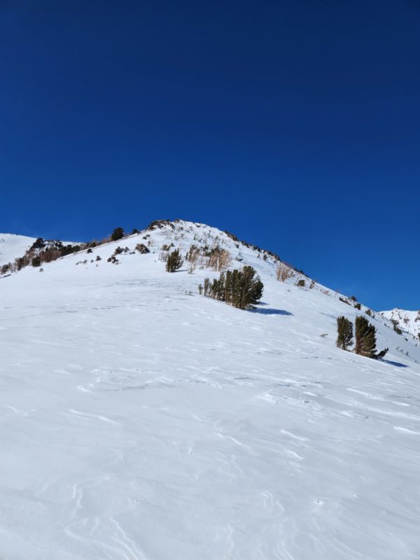
June LakeLocation:
June Lake Area - Hedging Our BetsSigns of Unstable Snow
Recent Avalanches?
YesCracking?
IsolatedCollapsing?
None ExperiencedKey Points
We toured around multiple aspects in the June area to get a hold of the distribution and sensitivity of today’s wind slab problem and assess how much snow is available for stronger winds to transport tomorrow – all with the persistent slab problem in the back of our minds.
- On the drive up from Bishop we saw isolated areas of blowing snow over ridges and peaks above treeline. These areas had big, open slopes upwind called fetches where the wind can scour the snow and move it onto leeward aspects. We saw moderate blowing snow near and above treeline around June Mountain and San Joaquin Ridge, including into the popular gully feature we had intended to ascend.
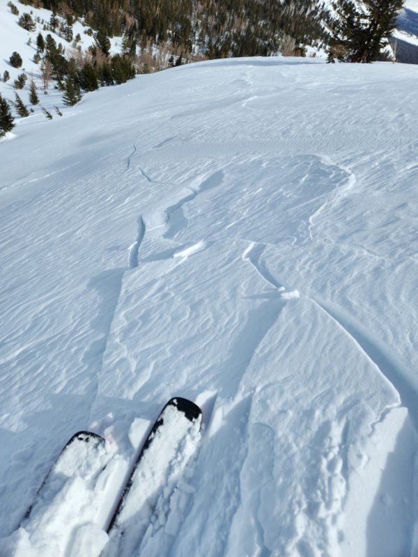
- On a northeast-facing test slope at 9500 feet near treeline, we triggered long shooting cracks and a small wind slab avalanche. We also got small slabs to break out on isolated features above treeline. We saw no recent natural avalanches and it’s worth noting that we saw several sets of tracks from today in steep, leeward, alpine terrain with no observable triggered avalanches.
- So, we saw blowing snow into our chosen route: a confined feature with a steep section. We got direct feedback from the problem when we triggered cracks and slabs on test slopes with the same aspect as our intended route. And, we knew that the persistent slab problem can be found on the same aspect and that we might be able to trigger it with a relatively smaller wind slab avalanche. We chose to play it safe and ascend a scoured ridgeline that wraps onto a sheltered, lower-angled southeast-facing slope (an aspect less likely to have both the wind slab and persistent slab problems).
Media
Advanced Information
Weather Summary
Cloud Cover:
Partly CloudyTemperature:
20 degrees F at 10,600 feet in the afternoonWind:
Moderate , SW
Increasing clouds. Strong sun through the late morning and early afternoon had no effects on the snow on solar aspects. Winds may have decreased by early afternoon. We saw fewer areas of blowing snow on the drive home.
Avalanche Observations
| # | Date | Location | Size | Type | Bed Sfc | Depth | Trigger | Comments | Photo |
|---|---|---|---|---|---|---|---|---|---|
| 1 | Today |
Above the headwaters of Deadman Creek, South of the Hourglass NE 9600 ft. |
D1 | SS | S-New Snow | 6 inches |
AS-Skier c-Intentional |
4-finger plus slab. 40 ft wide and 10 ft downslope. The test slope was near treeline on a convex roll - the sidewall of a gully. | None |
Snowpack Observations
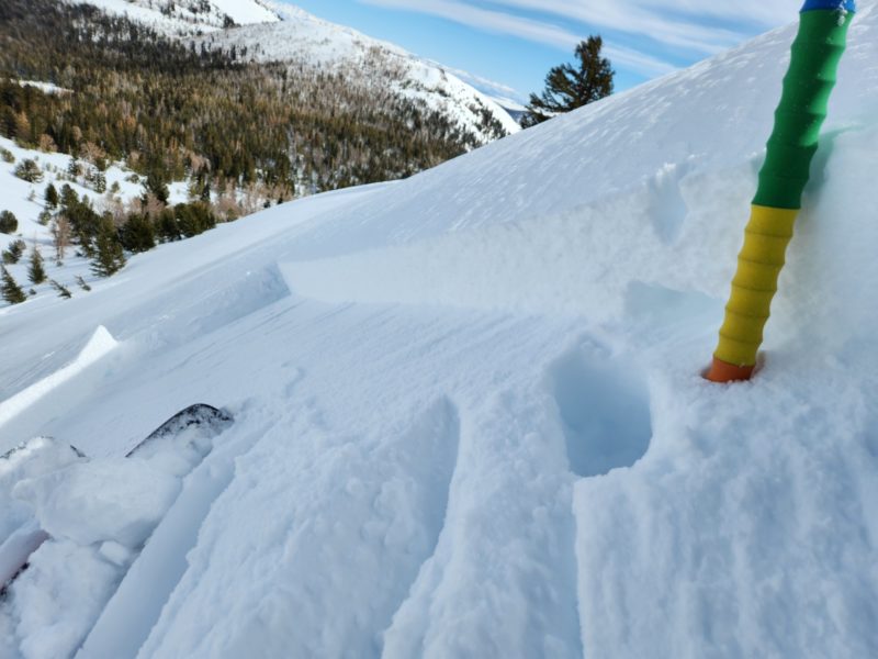
We stomped around in a windward fetch and got 30 cm boot penetration through F to 4F decomposing/fragmented grains. Solar aspects were scoured to wind board or sastrugi above treeline, melt-freeze crusts near treeline. We found spotty crusts near and below treeline interspersed with 4F-F snow available for transport. Winds were pulling snow from all the way down in low elevation sheltered windward slopes.
We didn’t dig for the persistent weak layer, though we probed around for it on a northeast aspect near treeline and felt our probes fall through a stiff layer into a softer layer between 220 and 250 cm below the surface. Given that we dug on a similar aspect and elevation in the area before the most recent storm and found the layer down 140 cm below the surface (before an additional 2-3 feet of new snow) I would bet that the soft layer we found is the PWL. We didn’t get any collapsing or other signs of instability from this layer in our tour.