
Professional Observation
Basic Information
Observation Details
Observation Date:
March 22, 2023Submitted:
March 23, 2023Observer:
Steve Mace | ESAC ForecasterZone or Region:
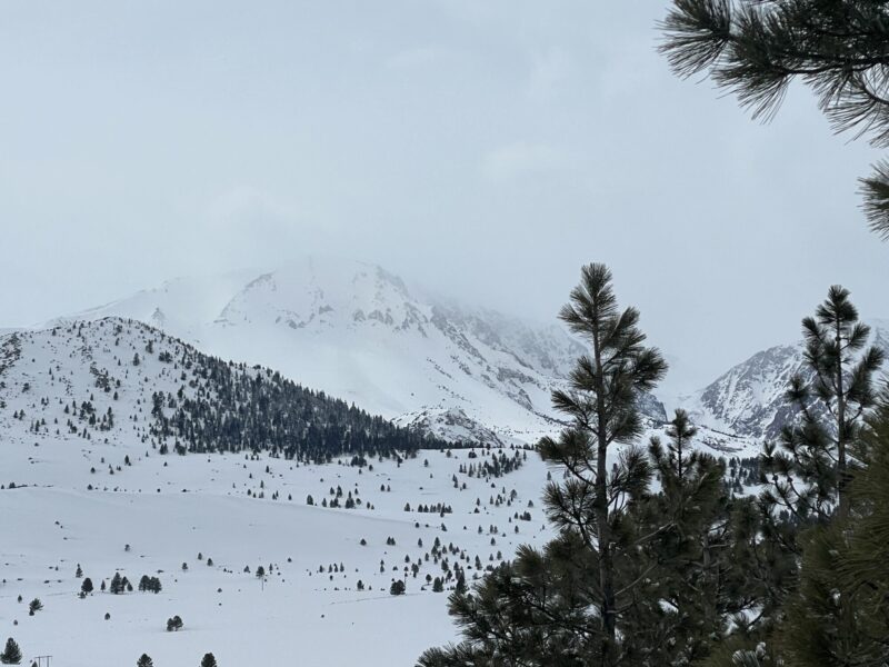
Mammoth LakesLocation:
June Lake area - Reactive wind depositsSigns of Unstable Snow
Recent Avalanches?
YesCracking?
IsolatedCollapsing?
None ExperiencedKey Points
Time restraints and limited parking options kept me in below treeline terrain today but I did manage to find some interesting observations in the June lake area this afternoon.
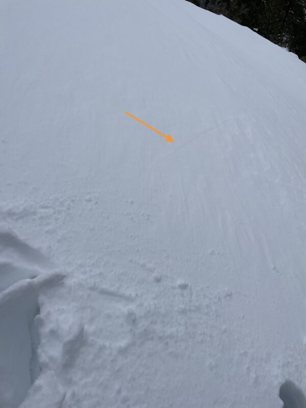
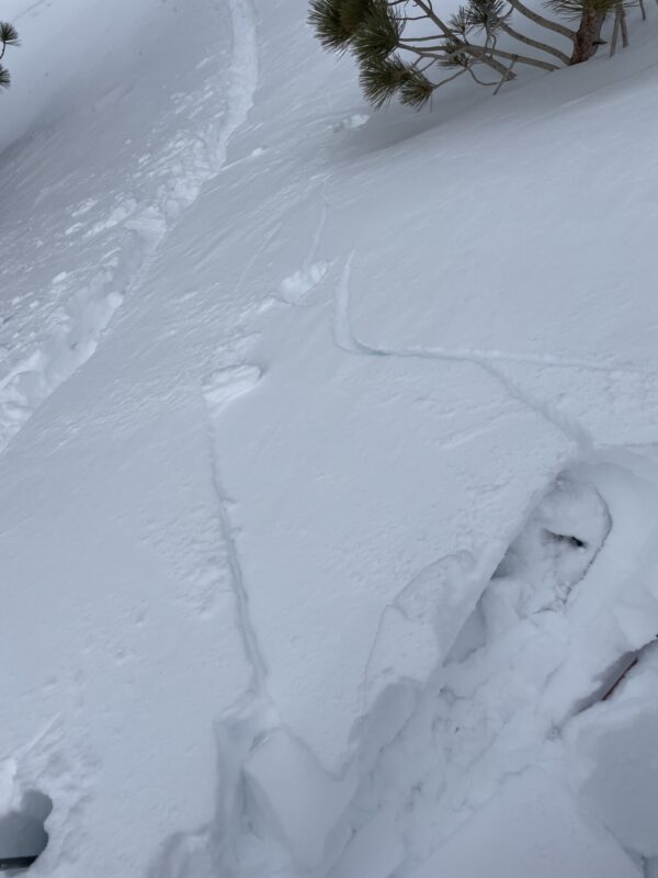
Fresh wind deposits were reactive under my weight in exposed areas and leeward catchment zones. Wind compressed snow was about 1 f and these slabs were resting on f-4f snow comprised of decomposing precip particles below. Shooting cracks as long as 10′ and about 12″ or so deep were observed on test slopes. I did not observe any very large catchment zones but it was easy to kick off large table sized panels by undercutting wind rolls. and hand sheers were breaking with isolation.
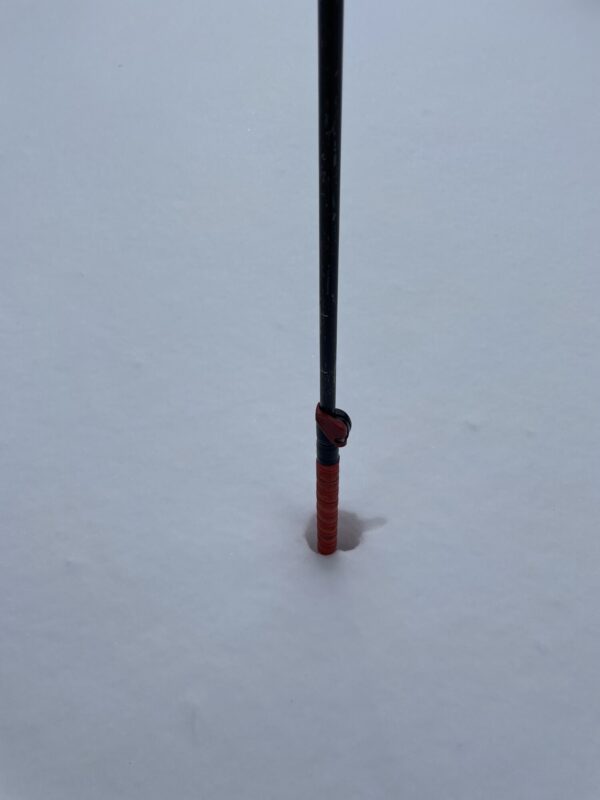
recent snow accumulations in the area averages about 12-18 in below 9000′ but a significant rain crust was observed at lower elevations which seemed to cap out around 8000′. Above 8000′ ski pen was a bit deeper as i was cutting into older still unconsolidated snow.
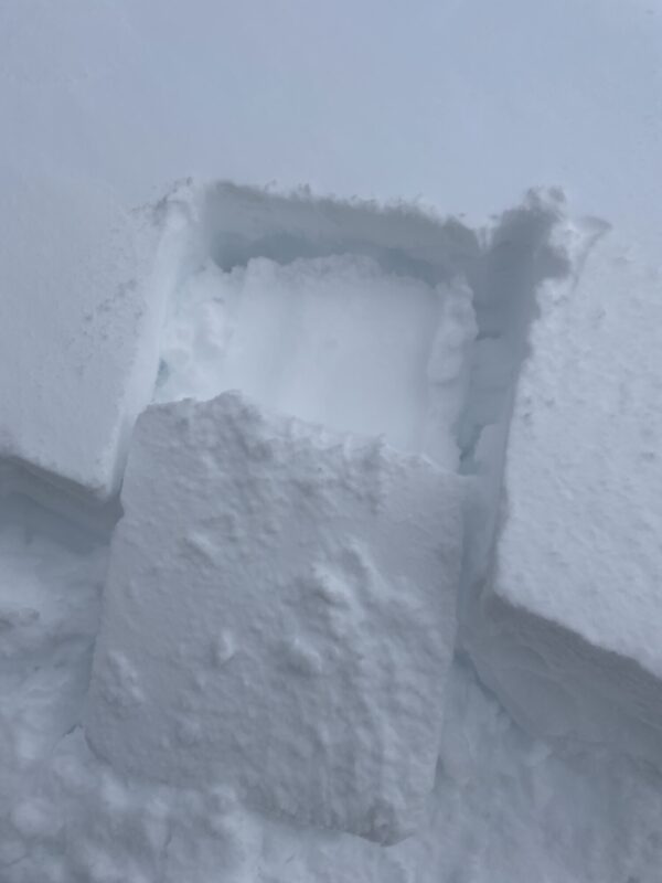
I dug a quick pit around 9000′ on a NE aspect to get a look at the storm interface. In the location that i dug i found mostly rightside up storm snow with a notable density change about 55 cm down. This fist hard layer, sandwiched between 4f+ storm snow and a 1f hard layer below, was reactive to my stability tests (CT14SP, ECTn24). This weak layer was comprised mostly of decomposing facets with some minor near surface faceting present. This weak layer did not jump out as super concerning at this location but it made me wonder if faceting may have been more prominent where a crust layer is also present.
No other signs of instability were noted along my tour but i did not that even brief windows of sun this morning had stiffened surface snow in solar areas. While this was not a wet concern today it did highlight the strength of our March sun.
Along my drive I observed a significant debris pile on the East face of Mt Wood but continued snow showers did not allow a good view of the crown. (see photo)
Media
Advanced Information
Weather Summary
Cloud Cover:
OvercastTemperature:
-4°cWind:
Light , SW
Cloud cover increased this afternoon and temperatures remained quite cold. Winds seemed more prominent at higher elevations and some wind transport was noted along the high ridge tops. Where I was below 9000′ winds were mostly light with occasional gusts reaching moderate speeds.
Close