Professional Observation
Basic Information
Observation Details
Observation Date:
February 1, 2023Submitted:
February 1, 2023Observer:
Everett Phillips | ESAC ForecasterZone or Region:
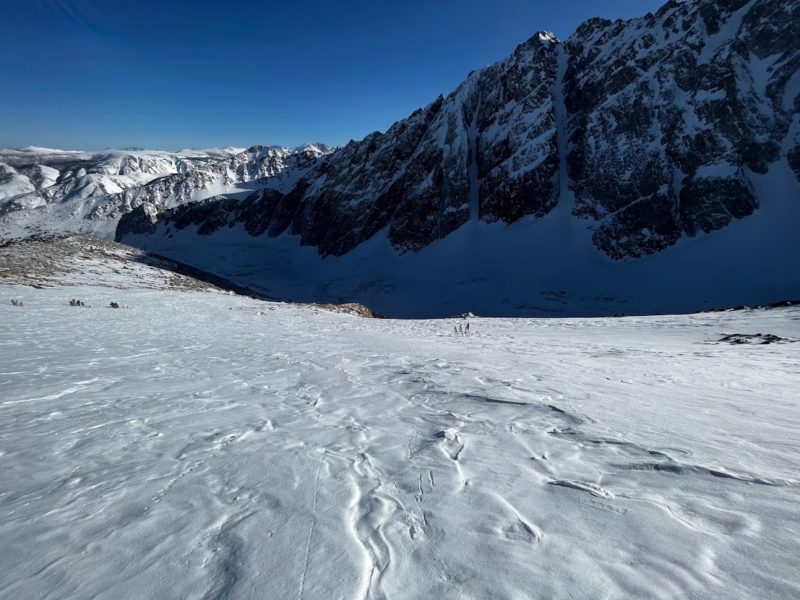
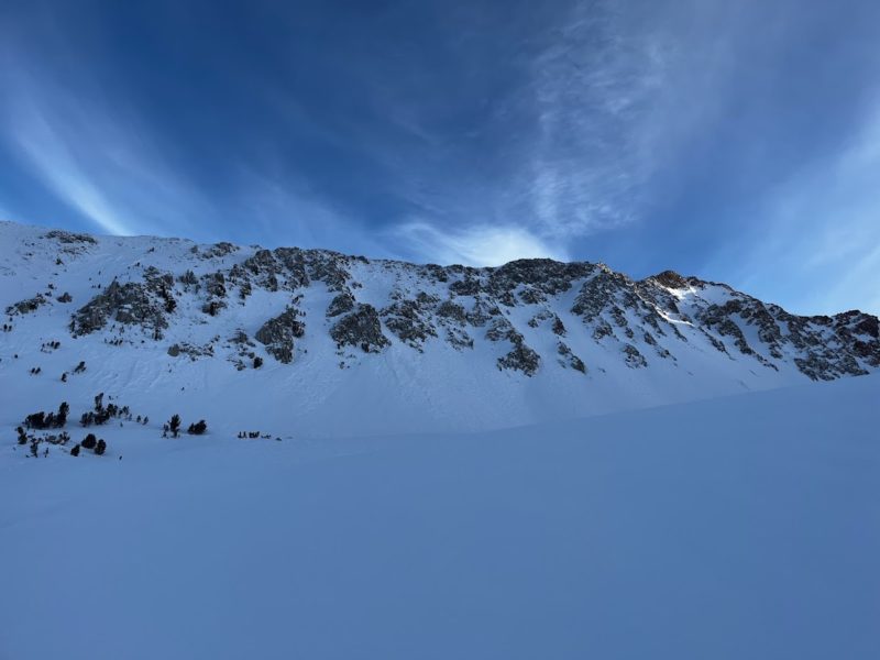
Bishop CreekLocation:
Bishop Creek - Alpine ConditionsSigns of Unstable Snow
Recent Avalanches?
None ObservedCracking?
None ExperiencedCollapsing?
None ExperiencedKey Points
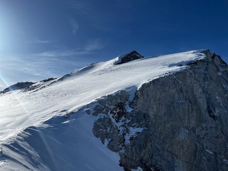
I used the low angle SE face of Checkered Demon to get up to ridgelines in Bishop Creek today.
- There is less recent snow (2-4″) in the Bishop Creek area than in other areas visted by ESAC observers recently.
- The general structure of the upper snowpack consists of about 15 to 20cm of facets and decomposing precip particles covered by a variety of strong crusts depending on aspect with just a few inches of recent F- snow on top.
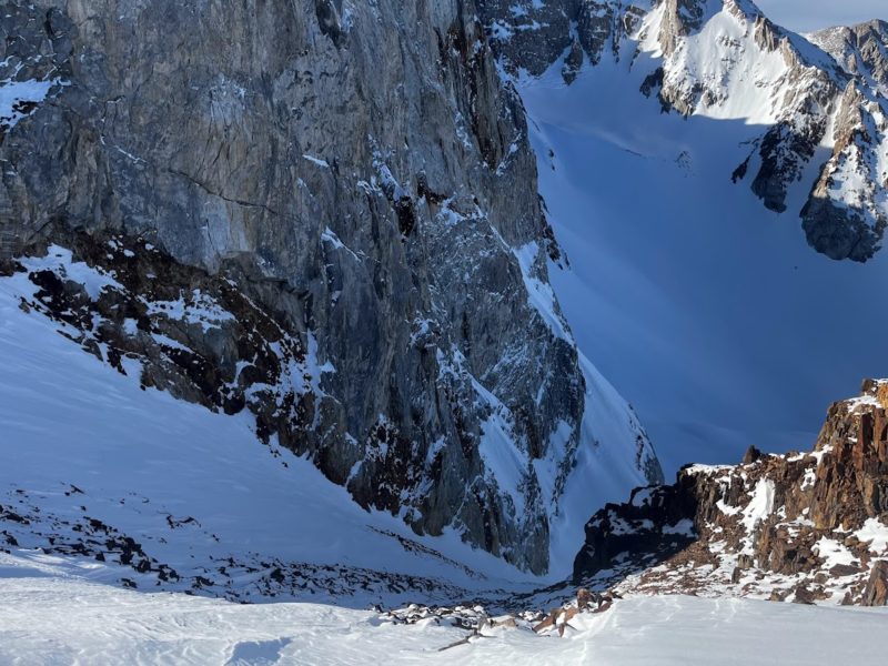
- Above treeline the recent snow has either been hardened into wind board and sastrugi, or blown off of start zones to lower angle terrain in the tracks and runouts of avalanche paths.
- I made an honest effort to find wind slabs to evaluate in the alpine today without much luck. In Bishop Creek they must be very isolated in distibution.
- Temperatures stayed within reason today and no loose wet activity was observed.
- Challenging surface conditions seemed to me to be a greater hazard than avalanche problems in this area today.
- Ski crampons were the MVP today.
Media
Advanced Information
Weather Summary
Cloud Cover:
ClearTemperature:
21 F @ 12500' (2pm)Wind:
Calm
Air temperature was 37 F in Aspendell at 11 AM.
It was 22.5 F at 10,500′ at 12:30 PM.
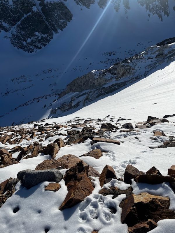
Solar aspects got sun for most of the day and there was melting in the surface snow on south aspects into the alpine. At lower elevations only steep north facing snow escaped the warming. There was some degree of temperature or sun crusts on most aspects BTL by late afternoon.
Snowpack Observations
- Recnt snow was 5-10cm and generally not cohesive. Much less than that above treeline. Up to 20cm in favored terrain features near and below treeline.
- The softest and deepest deposits of recent snow were in shaded canyons and north facing sidewalls of gullies near treeline, but skis were still riding on firm surfaces below.
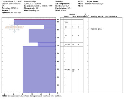
- Height of snow in the alpine was less than expected. In protected north and east terrain there is generally more than 3m of snow, but as you get onto aspects and slopes that have exposure to recent wind events snow heights drop. On west aspects at all elevations HS ranges from 25 cm up to 150cm. The snowpack on west aspects is weak where the wind layer are not too thick. In filled in gullies on S aspects above treeline HS is shallow and variable. On the slope I tested (see attached profile) it was between 50 and 150cm.
- Solar aspects near and below treeline now have widespread, and in some cases, supportable melt freeze crusts.
- South aspects above treeline are developing melt-freeze crusts, especially on steeper slopes. These crusts are not providing a predictably supportable travel surface.