
Professional Observation
Basic Information
Observation Details
Observation Date:
January 30, 2023 - January 30, 2023Submitted:
January 30, 2023Observer:
Clancy Nelson | ESAC ForecasterZone or Region:
Mammoth LakesLocation:
Mammoth Lakes Basin - Sluffs and Soft Wind SlabsSigns of Unstable Snow
Recent Avalanches?
YesCracking?
IsolatedCollapsing?
None ExperiencedKey Points
I kept moving in the Mammoth Lakes Basin trying to keep myself warm while looking for loose snow avalanches and wind slabs. I found both…and almost stayed warm enough.
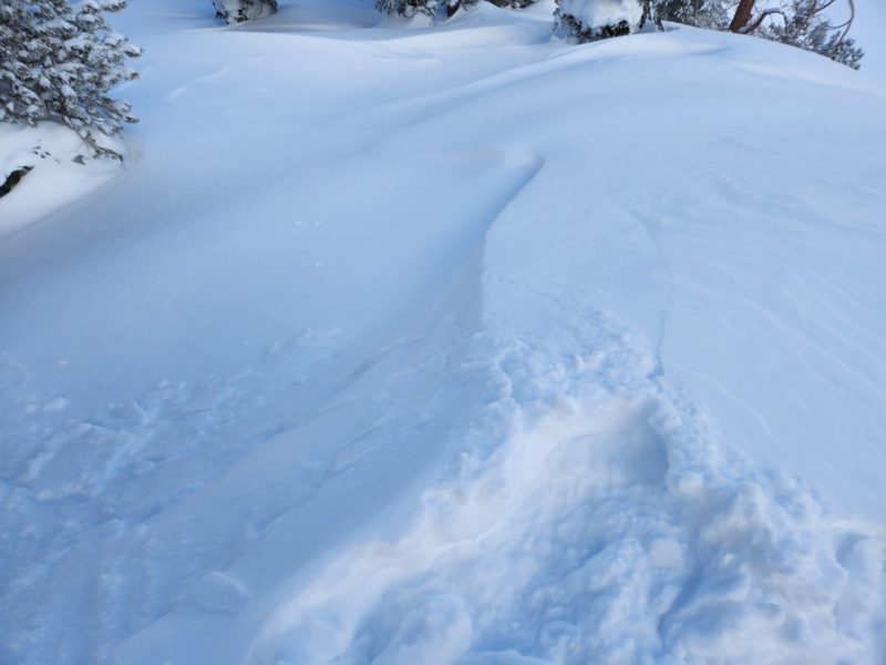
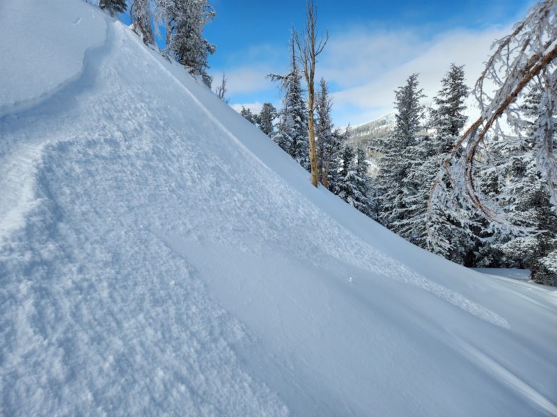
- I saw a few small natural sluffs and it was easy to trigger loose dry avalanches on just about any slope steeper than 35 degrees near and below treeline. These were up to 8 inches deep and long running on recently buried hard surfaces or facets. They never grew large enough to bury someone in the terrain where I tested them, but they let me know I should watch out for terrain traps below.
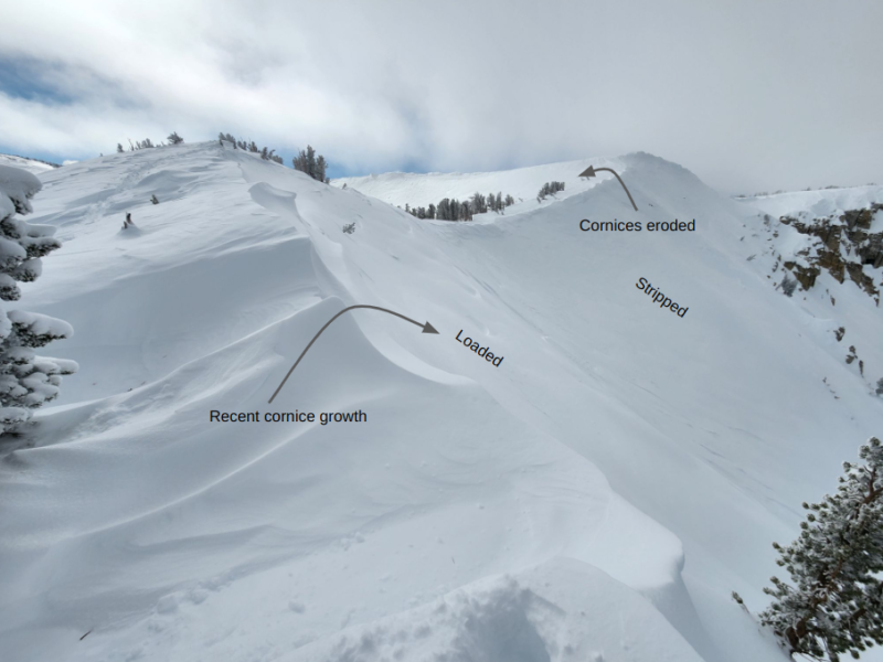
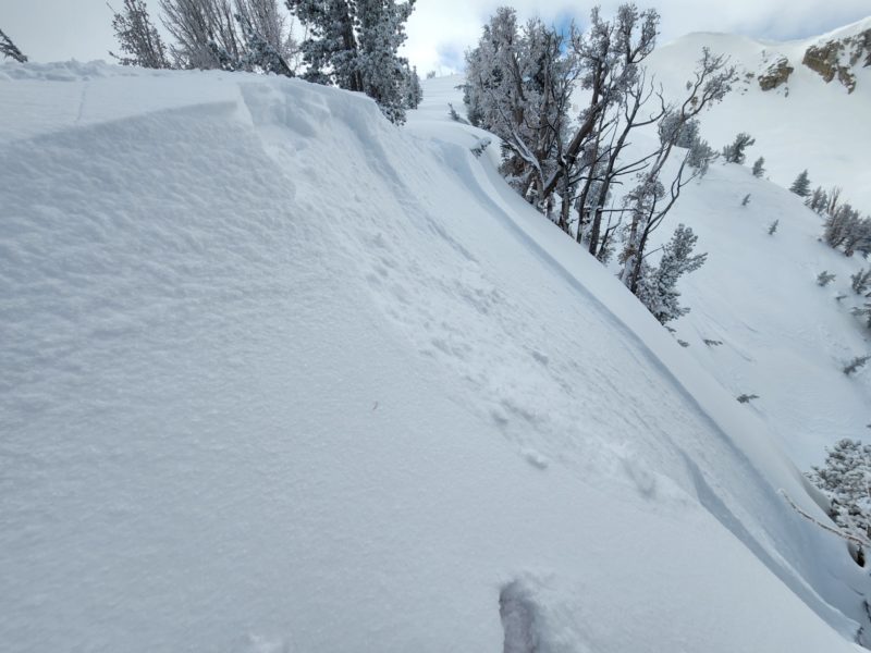
- I found soft (F+) wind slabs on many aspects near treeline. These were up to 16 inches thick at the top and tapered quickly down the slope. I got shooting cracks walking around in a few of them on both east- and west-facing slopes. Above treeline wind slabs were up to 2.5 feet thick and stiffer (4F). The distribution up higher seemed predominately from northeast winds – east slopes were stripped down to old sastrugi, northerly slopes were cross-loadded, and westerly slopes were loaded. These also tapered as they went from the ridgeline down the slope. When I triggered wind slabs on test slopes they would break on F- precipitation particles and crack at the crown. Then the debris was so soft it behaved like a sluff. They did not propagate widely.
- Winds were light when I reached the Mammoth Crest, but they picked up quickly from the northeast and began moving more snow onto south and west aspects as I left. I saw the same pattern on higher peaks and near the Sierra Crest on my drive back down to Bishop. The wind chill was truly cold.
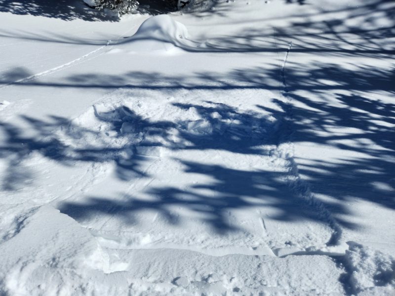
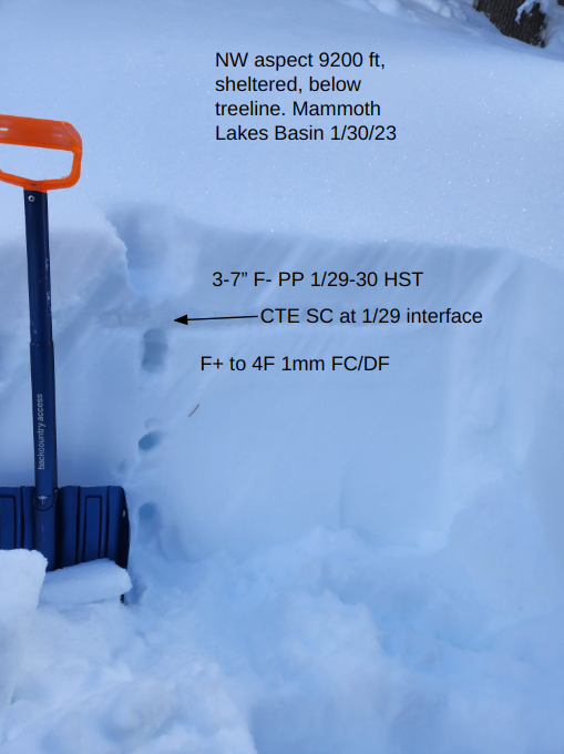
- I stopped to test the upper snowpack in a sheltered area below treeline. On a northwest-facing slope it was easy to identify the interface between the unconsolidated new snow (about 3 to 7 inches of it) and the recently buried facets in a shovel tilt test. I got easy small column results that collapsed suddenly at the same interface. The new snow was too soft to give any feedback in long column tests.
Media
Advanced Information
Weather Summary
Cloud Cover:
Partly CloudyTemperature:
Low teensWind:
Light , NE
Gradually clearing into the early afternoon. Winds increased from the northeast by 1300.
Avalanche Observations
| # | Date | Location | Size | Type | Bed Sfc | Depth | Trigger | Comments | Photo |
|---|---|---|---|---|---|---|---|---|---|
| 3 | Today |
George Headwall E 9500 ft |
D1 | L | S-New Snow | N-Natural | None | ||
| 2 | Today |
Lake Mary Rd/Tamarack E 8750 ft |
D1 | L | I-New/Old Interface | 3 inches |
AS-Skier c-Intentional |
None | |
| 4 | Today |
Red Cone Ridge W 10100 ft |
D1 | L | I-New/Old Interface | 8 inches |
AS-Skier c-Intentional |
None | |
| 2 | Today |
Red Cone Ridge W 10200 ft |
D1 | SS | I-New/Old Interface | 1 ft |
AS-Skier c-Intentional |
None | |
| 2 | Today |
Red Cone North Trees NE 9700 ft |
D1 | L | S-New Snow | 6 in |
AS-Skier c-Intentional |
None |