
Professional Observation
Basic Information
Observation Details
Observation Date:
January 13, 2023 - January 13, 2023Submitted:
January 13, 2023Observer:
Clancy Nelson | ESAC ForecasterZone or Region:
June LakeLocation:
June Lake Area - Increasing WindsSigns of Unstable Snow
Recent Avalanches?
YesCracking?
IsolatedCollapsing?
None ExperiencedKey Points
We spent a short field day near June Mountain watching the first in a series of winter storms roll into the forecast area.
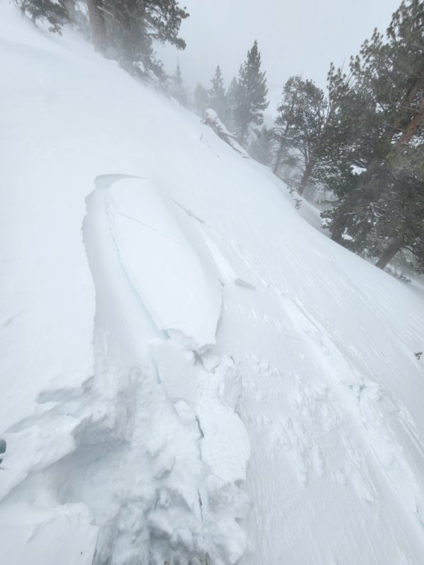
- We triggered small wind slab avalanches on test slopes near treeline. We found cornices to be sensitive to stomping. Wind and snowfall increased by midday. Moderate to intense blowing snow was common.
- The top 3 inches of snow was still wet this morning below treeline and we saw natural rollerballs and small wet loose avalanches from very steep terrain near trees and rocks. These were all below about 8100 feet. By about 11:30 am the surface began to refreeze as temps dropped and winds increased. New and drifted snow will fall on a melt-freeze crust at those lower elevations. The snow underneath the crust was still moist down about 6 inches below the surface; dry under that. The crust was spottier – confined only to terrain that usually gets sun – between 8100 feet and our high point of 9000 feet.
- We dug a hasty pit on a northeast aspect at 8900 feet where the total snow depth was 220 cm. We found all dry snow, mostly right-side-up, to pencil hard. That structure sat atop a knife-hard rain crust from the last rain event buried 155 cm deep. We got no propagation in our snowpack test.
More snow and wind are on the way overnight. Expect stability to deteriorate into tomorrow.
Media
Advanced Information
Weather Summary
Cloud Cover:
Mostly CloudyTemperature:
Above freezing decreasing to the upper teens after noon.Wind:
Moderate , SW
Snowfall started early in the northern part of the forecast area – around 11am. It increased from S-1 showers to S1 by 1 pm.
Winds were moderate with strong gusts at all elevations where we traveled. Though blowing snow was isolated until noon when moderate to intense blowing snow was constant.
Avalanche Observations
| # | Date | Location | Size | Type | Bed Sfc | Depth | Trigger | Comments | Photo |
|---|---|---|---|---|---|---|---|---|---|
| 2 | Today |
Little Wing E 9000 ft |
D1 | SS | I-New/Old Interface | 6 inches |
AS-Skier c-Intentional |
We also triggered several small cornices. | None |
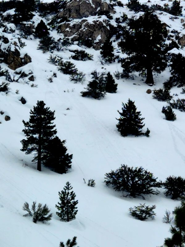
Wind slabs and cornices were growing near treeline on northwest, north, northeast, east, and southeast aspects.
Close