
Professional Observation
Basic Information
Observation Details
Observation Date:
November 17, 2022Submitted:
November 17, 2022Observer:
Clancy Nelson, Everett Phillips | ESAC ForecasterZone or Region:
Mammoth LakesLocation:
Lakes Basin - Mammoth Crest AreaSigns of Unstable Snow
Recent Avalanches?
None ObservedCracking?
None ExperiencedCollapsing?
None ExperiencedNone
Key Points
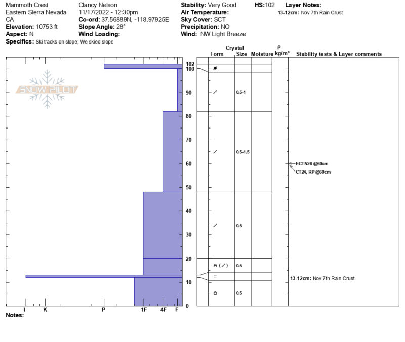
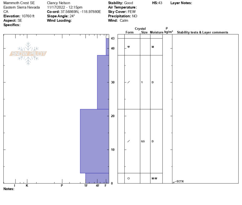
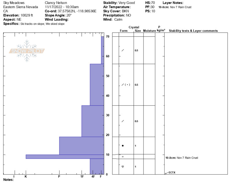
Today we were able to get a detailed look at the snowpack on a variety of aspects Below Treeline (BTL) and Near Treeline (NTL) in the Lakes Basin Area.
BTL Height of snow (HS) = 60cm. NTL HS = 40cm – 100cm.
In most areas BTL and NTL, the top 20cm of the snowpack is settled powder from the last storm. This makes for enjoyable riding where there is enough coverage.
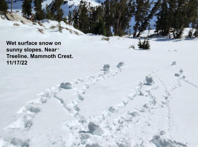
On slopes facing the sun (BTL and NTL) the surface snow was becoming wet by noon. Not wet enough to be concerned about wet snow instability today, but enough to develop melt-freeze crusts at the surface.
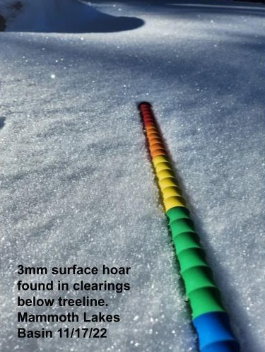
BTL the surface snow has begun to facet during this spell of cold clear weather. We observed surface hoar in some areas as well.
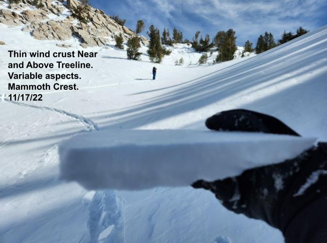
In isolated areas NTL we observed a thin wind crust at the snow surface. This crust shows up on a variety of aspects. It looks to be widespread Above Treeline (ATL).
Varying snow surfaces are our layer of greatest concern going forward.
Media
Advanced Information
Weather Summary
Cloud Cover:
Partly CloudyTemperature:
~ 35 FWind:
Calm
Slightly warmer today than it has been for the past week. Field temperatures were just above freezing at 10000′ at noon. Winds were calm. Scattered clouds overhead. No precip. today.
Terrain Use
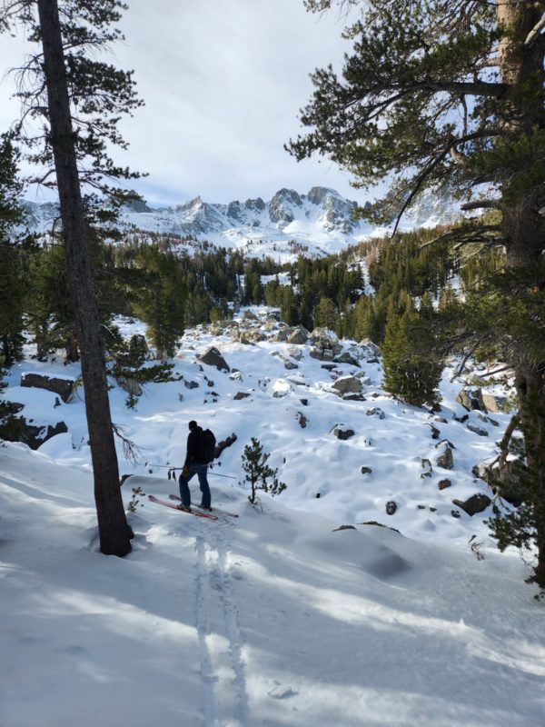
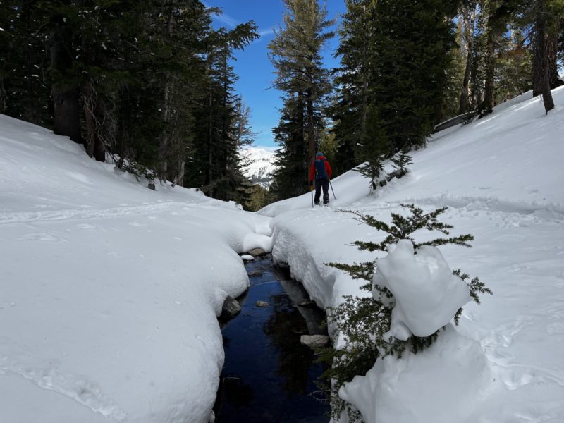
Boulder fields, creeks, and large deadfall are still exposed in many areas. These obstacles are the main hazard facing backcountry riders in the Lakes Basin at the moment. Careful route finding and conservative riding are key to managing early-season conditions.
Close